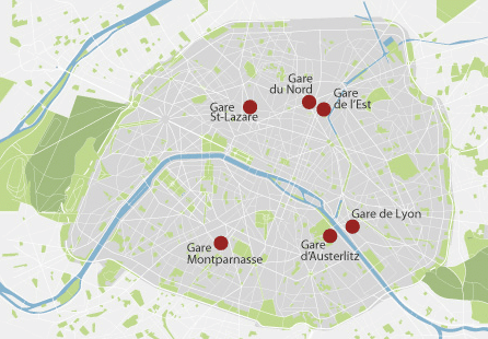
EPE’25, the 26th European Conference on Power Electronics and Applications, will take place in Paris, the capital of France. With over 2,000,000 inhabitants, Paris is one of the most populous cities of the European Union (after Berlin, Madrid and Rome).
Paris is located in northern central France, on both banks of the river Seine, and it is a major hub for rail, highway, and air transportation.
Paris Orly Airport is the second international airport serving Paris. Orly is the busiest French airport for domestic traffic and the second busiest French airport overall in passenger traffic. It is located 13 km south of Paris.
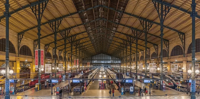
From Gare du Nord, one of the busiest railway stations in the world, trains leave to the north of France, as well as to Belgium, the Netherlands, Germany and Great Britain. It also an important hub in the Paris urban transportation network, including the RER and the Paris Metro. The RER train from Charles de Gaulle Airport (line B) connects at Gare du Nord.
TGV to Lille and London
TGV to Brussels and Amsterdam
TGV to Brussels, Cologne and Essen
Copyright: photo Wikimedia by Diliff
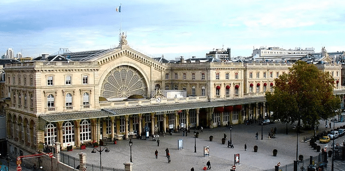
Gare de l'Est
From Gare de l’Est, the near neighbor of Gare du Nord and one of the oldest stations in Paris, trains depart in the direction of the east of France, Luxemburg and Germany, such as Strasbourg, Frankfurt, Berlin, Hamburg, and Munich.
High-speed trains to Berlin
High-speed trains to Innsbruck
TGV to Reims (Champagne)
TGV to Luxembourg
Copyright: photo Wikimedia by Gilbert Bochenek
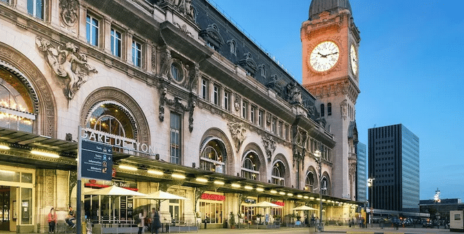
Gare de Lyon
Gare de Lyon, with a clock tower, connects Paris to the south and the east of France (Rhone Valley, Provence, and the French Riviera), as well as to destinations in Switzerland, Germany, Italy and Spain.
TGV to Lyon
TGV to Avignon – Marseille
TGV to Geneva
TGV to Milan
Copyright: https://www.parisinsidersguide.com/
Gare d'Austerlitz
From Gare d’Austerlitz, on the border of the 13th and 5th Arrondissements, the trains leave towards the center and the south-western part of France (the Mediterranean coast).
Austerlitz is currently being renovated completely, to modernize the station and the neighborhood, to make them more green, and to add tracks for high-speed trains serving southwest France.
Copyright: https://www.parisinsidersguide.com/
Gare Montparnasse
From Gare Montparnasse, trains leave direction the west and south-west of France, including Bordeaux, Tours, Nantes and Rennes. Gare Montparnasse, a major urban terminus, is connected to Metro lines 4, 6, 12 and 13.
Normandy: Granville
TGV to Brittany: Rennes, St. Malo, Brest
TGV to the Loire Valley: Nantes, Angers
Central France: Chartres, Tours
TGV to Poitou-Charentes
TGV to Aquitaine: Bordeaux, Bayonne, Biarritz
TGV to Midi-Pyrenees: Toulouse, Lourdes
Spain: San Sebastian and Madrid
Portugal
Copyright: https://www.parisinsidersguide.com/
Gare Saint-Lazare
Gare Saint-Lazare, a major source of inspiration for impressionist painters such as Edouard Manet and Claude Monet, serves the west of France. It serves destinations like the Mont-St-Michel and the city of Dieppe. It is connected to Metro lines 3, 12, and 13.
Copyright: https://www.parisinsidersguide.com/
By Car:
Paris is, of course, also the most important hub of France’s motorway network. It is surrounded by three orbital freeways: the Périphérique, the A86 motorway in the inner suburbs, and finally the Francilienne motorway in the outer suburbs. Paris has an extensive road network with over 2,000 km of highways and motorways.
A1, A3, A4, A5, A6, A10, A13, A14, A15, A16 radiate clockwise from Paris, with A2, A11, and A12 branching respectively from A1, A10, and A13.
France has a considerable network of tolled motorways. Toll costs vary according to the motorway you’re driving on, the distance travelled and the type of vehicle you drive. Further, to improve air quality, Paris has become a limited traffic zone. All vehicles must display a Crit’Air sticker with a number ranging from 1 to 5. This indicates the level of pollution in ascending order. In the event of high pollution levels, even vehicles with low-number stickers can be banned from circulating.
It is not (always) easy to drive in Paris, or to find a parking spot. And it is not good for the carbon footprint either. Therefore we do not recommend that you come to EPE’25 in Paris by car.
By Bus:
EPE’25 participants who wish to travel to Paris by bus, are likely to arrive at the Paris-Gallieni bus station. It is located in Bagnolet in the east of Paris. From here, they may need to take a connecting bus service to the center of Paris. There are also several large bus terminals around the city that serve the Paris area.
Gare Routière Internationalede Paris (Paris International Bus Station), 6 km east of the city center at Porte de Bagnolet where the Boulevard Péripherique meets the E-15 autoroute, is the starting and ending place for intercity and international buses operated by Eurolines and Ouibus.
The terminus of Metro Line 3, Gallieni, is located near the bus terminal.
Flixbus stops at the station Paris Bercy Seine, in the east of the city, near Gare de Lyon. Paris Métro will take you further to Paris City Center.
The Réseau Express Régional (English: Regional Express Network), commonly abbreviated RER, is a hybrid commuter rail and rapid transit system serving Paris and its suburbs. It acts as a combined city-center underground rail system and suburbs-to-city-center commuter rail. In the city center, it acts as a faster counterpart of the Paris Métro. Click HERE for the interactive map.
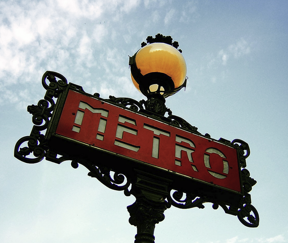
Paris Métro:
The Paris Métro (French: Métro de Paris) is a rapid transit system in the Paris Metropolitan Area. The system is 226.9 kilometres (141.0 mi) long, mostly underground. It has 308 stations, of which 64 have transfers between lines. There are 16 lines in total, with 4 more being under construction. The lines are identified on maps by number and colour, with the direction of travel indicated by the terminus. It is the second busiest metro system in Europe. Click HERE for the interactive map.
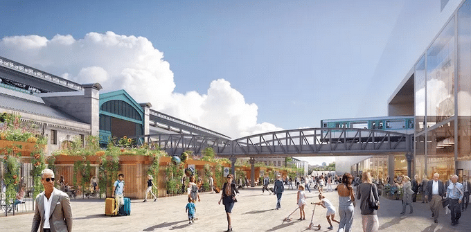
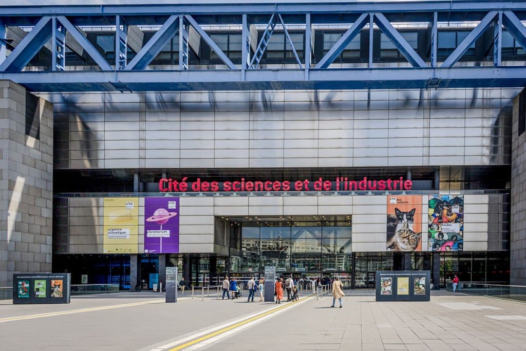
The Conference Center:
La Villette Congress Centre is a part of the Cité des sciences et de l’industrie. The complex is located north-east of the city centre of Paris.
Copyright: Arnaud ROBIN
The address is:
La Villette Congress Centre 30, avenue Corentin Cariou 75019 Paris France
Bus lines 150, 54 and 60 pass near the conference centre. The nearest bus stop is “Porte de la Villette”.
Tramline T3B stops at “Canal Saint-Denis”, 650-700 meters (a 10 minute walk) from the Cité des Sciences et de l’Industrie.
We use cookies to ensure that we give you the best experience on our website. If you continue to use this site we will assume that you are happy with it.